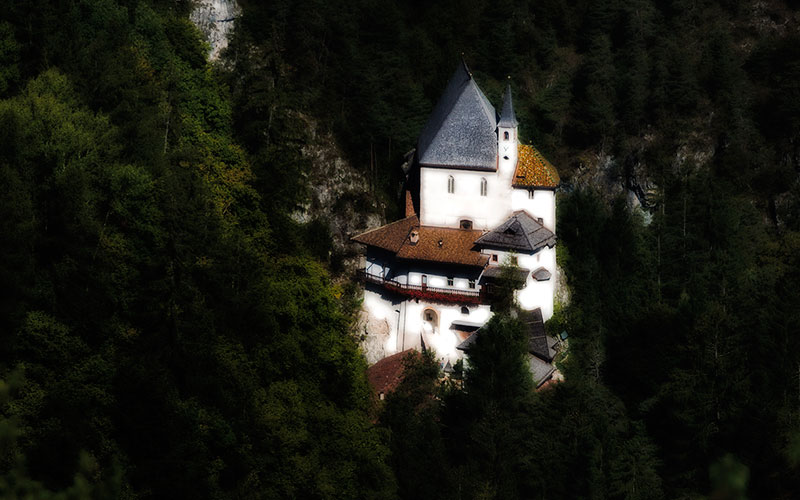
This frequently-visited place of pilgrimage is a mystical location, which invites the visitor to stop and linger for a while. Right beside the abbey is a a bear enclosure. The trail becomes somewhat steeper heading up to the lake Lago di Tavon and from there the trail ascends, in some parts quite steeply, through the forest to a viewpoint with an excellent vista over San Romedio and the nearby Brentagroup. The hike follows an almost flat forest promenade through the shady trees to the village of Smarano. Along the way there are another couple of viewpoints offering great sights on to the two underlying lakes Lago di Tavon and Lago di Coredo, as well as the rock towers of the Brentagroup. From Smarano it is only a short hike to the charming village of Sfruz.
fourth day
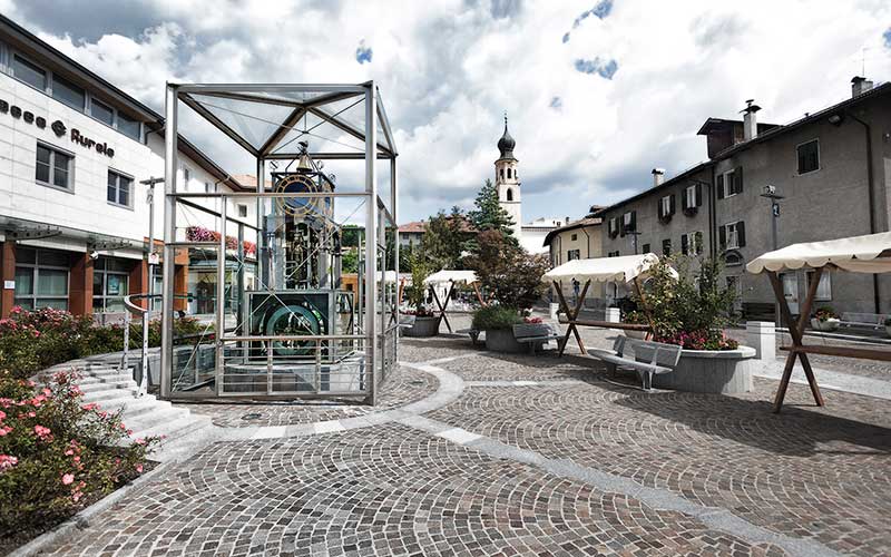
from village of Fondo to village of Sfruzrom Fondo the next section of the trail leads in the direction of the abbey of San Romedio, through the gentle low mountain range landscape of the Nonsberg, perpetually radiating peace and tranquility. At the beginning the route is fringed by neatly arranged orchards and nice meadows. There is no traffic noise to disturb the hiker in this lovely countryside. Even the fact that the bike trail (which is equally used by hikers) is paved, will not detract from this relaxing stage via the village of Romeno to the village of Salter. From Salter the descent proceeds over a sometimes narrow and slippery forest path into the picturesque ravine leading to the abbey of San Romedio.
rom Fondo the next section of the trail leads in the direction of the abbey of San Romedio, through the gentle low mountain range landscape of the Nonsberg, perpetually radiating peace and tranquility. At the beginning the route is fringed by neatly arranged orchards and nice meadows. There is no traffic noise to disturb the hiker in this lovely countryside. Even the fact that the bike trail (which is equally used by hikers) is paved, will not detract from this relaxing stage via the village of Romeno to the village of Salter. From Salter the descent proceeds over a sometimes narrow and slippery forest path into the picturesque ravine leading to the abbey of San Romedio.
This frequently-visited place of pilgrimage is a mystical location, which invites the visitor to stop and linger for a while. Right beside the abbey is a a bear enclosure. The trail becomes somewhat steeper heading up to the lake Lago di Tavon and from there the trail ascends, in some parts quite steeply, through the forest to a viewpoint with an excellent vista over San Romedio and the nearby Brentagroup. The hike follows an almost flat forest promenade through the shady trees to the village of Smarano. Along the way there are another couple of viewpoints offering great sights on to the two underlying lakes Lago di Tavon and Lago di Coredo, as well as the rock towers of the Brentagroup. From Smarano it is only a short hike to the charming village of Sfruz.
- 750 m
altitude difference uphill - 730 m
altitude difference downhill - 16.4 km
length of the trail - 6-7 hours
time needed – not including rest periods
Route description
From the village square in Fondo (978 m) hike past the tourist association (Pro Loco) down to the main road and turn left on the main road toward Bozen – Mendelpass (street signs). Shortly afterward a small road branches off to the right (street sign “Vasio”). Follow the road to the first crossing and continue walking straight ahead (bike path to Romeno). At the following crossing keep right until the sign for the bike path is reached. Follow the bike path to a left turn, and immediately afterward a small chapel, where a trail branches off to the right. Keep on hiking straight to the next T – section and turn right (this is still the bike path). Walk to the main road which connects the village of Sarnonico with Seio. Cross this road and keep walking straight ahead to the Golf Club Dolomiti (on the right). Carry on until the trail leads through a section of forest. There is a fork at the exit of the forest. Keep left and head toward a prominent knoll (patch of forest) with a children’s playground. Leave the playground to the left and follow the road to the village of Romeno (960), descending to the main road. Cross the road, hike to the village church and continue straight through to the last houses at the south end of the village. Follow the bike path in the direction of Salter (972 m). At the village entrance of Salter hike straight down the small road, which eventually leads to the right, and to a bigger intersection. Turn left at the intersection (signs “San Romedio” – trail marker 535). Here begins the steep, shady and often slippery path, which after approximately 300 m of descent ends in a picturesque canyon. Follow the road approximately 400 m into the main valley to the the stone stairs which lead to the renowned place of pilgrimage and abbey San Romedio (871 m). Follow the signs to Tres (trail marker SF – 535) across the entrance of the abbey and hike uphill alongside the creek. Disregard the small bridge on the right and continue straight to the next fork. Turn right (sign “Tres – trail marker SF). This leads to the small knoll called Dos Canestrin (820 m – sign) and shortly after there will be a fork (sign Smarano – trail marker SF). Walk steeply uphill to the lake Lago di Tavon (870 m). Turn left (sign Smarano, Tres – trail marker SF) and follow the lakeside to the north end of the lake where another sign indicates the way to Smarano, Tres (trail marker SF). Turning left the trail carries on to the beginning of a small forestry road (sign “Strada Forestale Savior”). At the following fork keep walking straight ahead in the direction of Smarano (sign). The trail through the forest becomes partly very steep and ends at a nice viewpoint. Turn right (sign “Smarano, Tres” – trail marker SF) and hike almost flat to a campground located on the right side (locality Merlonga, 1020 m – sign on the left side). Continue straight to a trail sign (Smarano, Tres – trail marker SF), and keep going for a short stretch to the asphalt road. Cross the road and walk straight ahead (poor trail signage / only red – white), crossing between the villas. The trail will lead to the fire station of Smarano (970 m). There will once again be signs here (Tres, Vervò – trail marker SF). Cross the main road and by the big concrete cross keep on descending straight down (poor trail signage / only red – white) to the crossing with the main road (sign “Tres, Vervò” – trail marker SF). Cross the main road and follow the road on the opposite side (poor trail signage) in the direction of the village center and church in Smarano. Briefly walk downhill to an interesting fountain (several bowls) and a public parking lot. At this point, turn left (poor trail signage) and follow the small road to the next fork. Keep right (poor trail signage) and hike downhill between a nicely renovated villa on the left side and a barn on the right to the next crossing, and more signage. Turn left and hike along a small road to the village center of Sfruz (964 m).
Terrain: 10.8 km Asphalt und 5.6 km forest- and meadow trails, path, forestry road.
Useful information
Possible rest stops along the route
Inns in Romeno and a small kiosk at the parking lot below the abbey of San Romedio
Accommodations for overnight stay
Agritur Cristina
Pineta Hotels
Tourist association
Maps
4Land – Sheet 155 – 1:25.000/ Val di Non
 GPX – Track download (134 KB)
 KML – Track download (8 KB)
 PDF – Route description and map download (6.8 MB)