Cross above the village to the locality of Santel, where the lifts to the Paganella ski area start. However, if the first stretch of the hike is shortened with a bus ride, it is necessary to get off right at Santel.
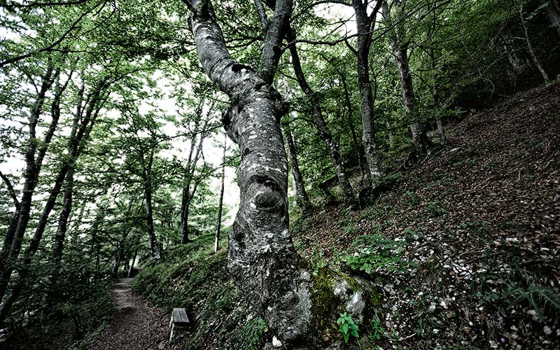
From here the Via Vigilius leads over paths and forestry roads down into the Val Manara and past the “Cors dei Frances”, where according to historical accounts, the French troops under Napoleon put up camp. Continue downhill to the “El Cason” a small, unmanned hut. At a nice view point above the Etschtal called “Mulinel”, follow the indications to the lake “Lago di Lamar”. Cross steeply uphill just below the Monet Paganella to reach a chute which, in 1955, was created by a huge landslide that almost entirely destroyed the underlying village of Zambana Vecchia. Another 400 meters of uphill will follow before reaching the picturesque lake “Lago di Lamar”. This is the first of three lakes on the plateau. The Lago Santo lies slightly to the south, while the Lago Terlago is situated near the village bearing the same name. Follow the lakefront of the Lago di Lamar and hike through a nice forest to the day’s destination of Vallene.
seventh day
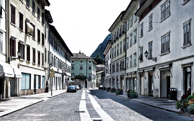
from hamlet of Monte to hamlet of Vallenehe mountain hamlet of Monte is left behind on this day, by floating down 620 m to Mezzocorona in 3 minutes, using the first tram in the morning. From the bottom station cross the village center to the station of the narrow-gauge railroad Trento-Malè. The station lies at the south end of the village. Take the train across the valley to Mezzolombardo, where the ascent to the village of Fai di Paganella begins. The section of Mezzolombardo-Vallene can be considered the “Queen” stage of the Via Vigilius. Only those who still feel fit after many days of hiking, and can still move quickly, should consider taking on this leg. Otherwise there is the possibility of taking the scheduled bus from Mezzocorona to Fai di Paganella and hiking from there to Vallene.
From Mezzolombardo the trail leads relatively steep and circuitous up to the plateau of Fai di Paganella.
he mountain hamlet of Monte is left behind on this day, by floating down 620 m to Mezzocorona in 3 minutes, using the first tram in the morning. From the bottom station cross the village center to the station of the narrow-gauge railroad Trento-Malè. The station lies at the south end of the village. Take the train across the valley to Mezzolombardo, where the ascent to the village of Fai di Paganella begins. The section of Mezzolombardo-Vallene can be considered the “Queen” stage of the Via Vigilius. Only those who still feel fit after many days of hiking, and can still move quickly, should consider taking on this leg. Otherwise there is the possibility of taking the scheduled bus from Mezzocorona to Fai di Paganella and hiking from there to Vallene.
From Mezzolombardo the trail leads relatively steep and circuitous up to the plateau of Fai di Paganella.
Cross above the village to the locality of Santel, where the lifts to the Paganella ski area start. However, if the first stretch of the hike is shortened with a bus ride, it is necessary to get off right at Santel.
From here the Via Vigilius leads over paths and forestry roads down into the Val Manara and past the “Cors dei Frances”, where according to historical accounts, the French troops under Napoleon put up camp. Continue downhill to the “El Cason” a small, unmanned hut. At a nice view point above the Etschtal called “Mulinel”, follow the indications to the lake “Lago di Lamar”. Cross steeply uphill just below the Monet Paganella to reach a chute which, in 1955, was created by a huge landslide that almost entirely destroyed the underlying village of Zambana Vecchia. Another 400 meters of uphill will follow before reaching the picturesque lake “Lago di Lamar”. This is the first of three lakes on the plateau. The Lago Santo lies slightly to the south, while the Lago Terlago is situated near the village bearing the same name. Follow the lakefront of the Lago di Lamar and hike through a nice forest to the day’s destination of Vallene.
Section from village of Mezzolombardo – lake “Lago di Lamar” – hamlet of Vallene
- 1,480 m
altitude difference uphill - 970 m
altitude difference downhill - 18.9 km
length of the trail - 8.5 – 9.5 hours
time needed – not including rest periods
Section from village of Fai della Paganella (locality Santel) – lake “Lago di Lamar” – hamlet of Vallene
Note: Mezzolombardo – Mezzocorona with the train. From Mezzocorona to Santel with the scheduled bus
- 690 m
altitude difference uphill - 950 m
altitude difference downhill - 13 km
length of the trail - 3 – 4 hours
time needed – not including rest periods
Route description
The trail to the high plateau of Fai della Paganella starts at the village border of Mezzolombardo (227 m) at the church San Giovanni. Walk uphill to the left of the church and follow the road to the last houses. The steep ascent (trail marker 602B) leads past the graveyard and up through the forest to the crossing with the trail 602C. Continue following the trail 602B uphill to the road to the village Fai di Paganella. Cross the road and hike above it to the spring “Fontana Fredda“. A nice panoramic trail (marker 680) crosses above Fai della Paganella (968 m) and parallels the road up to the Passo del Santel (1033 m), the highest point of this day’s section. Cross the main road to Andalo directly at the pass and on the opposite side follow Trail 680. The trail starts directly beside a hard-to-recognize electric power substation.
Hike downhill along paths and forestry roads, passing the “Cros dei Francesi” and descending into the Val die Menare. Continue the descent to the Cros dei Francesi, during which two forks will be encountered. At the first fork keep left (to the right the trail 682 branches off) and at the second one again stay left (to the right the trail 680A branches off). Carry on downhill to the unmanned hut “El Cason”. Keep on to the view point “Mulinel” and follow the signs to “Lago di Lamar”. Without any more forks the trail leads underneath the Monte Paganella and ascends another 400 meters to the locality Prà della Bedola (810 m). A brief descent leads to the lake “Lago di Lamar“. Just before reaching the inn “Ai tre Faggi” hike along the easterly lakefront to a fork and follow the signs to Terlago / Vallene. At the following fork keep right (sign “Terlago / Vallene”) and walk through the shady forest to the campground “Laghi di Lamar”. Another brief descent leads to the hamlet of Vallene (711 m).
Terrain from village of Mezzolombardo to hamlet of Vallene: 18.9 km forest – and meadow trails, path, forestry road.
Terrain from village of Fai della Paganella to hamlet of Vallene: 13 km forest – and meadow trails, path, forestry road.
Useful information
Public transport
Timetable narrow-gauge railway Trento – Malè / leg Mezzocorona-Mezzolombardo and scheduled bus from Mezzocorona to Fai della Paganella, locality Santel: www.ttesercizio.it/Treno
Possible rest stops along the route
Inns in Fai della Paganella, Albergo ai Tre Faggi in the vicinity of the lake “Lago di Lamar”
Accommodations for overnight stay
Agritur Vallene (holiday on a farm, open year round – www.prolocoterlago.it)
Tourist association
Maps
4Land – Sheet 139 – 1:25.000 / Gruppo di Brenta
 GPX – Track download (158 KB)
 KML – Track download (5 KB)
 PDF – Route description and map download (7.1 MB)