Over the summer months Malga Bodrina is manned and offers overnight stay as well. Soon the descent in the direction of the hamlet of Monte starts. An exposed traverse leads through a canyon. Being sure-footed is an essential requirement, because only short sections are secured with a steel cable acting as a hand rail. This leg should be negotiated without haste and with full attention. Shortly afterward a magnificent panoramic view over the Etschtal and onto the town of Trento, as well as onto the Monte Bondone, the Brenta- and Lagoraigroup and all the way to the Pale di San Martino far in the east opens up. Descending to the Baito degli Aiseli (1416 m) the way follows a beautiful trail with 217 steps down to the day’s destination, the small mountain hamlet of Monte (891 m).
sixth day
from village of Vigo di Ton to hamlet of Montehis is another day that requires endurance and another early start is recommended. Although the length of the route is not excessive, there is a substantial amount of elevation to traverse in the section, both in the ascent and in the descent. In addition, the most technically demanding part of the Via Vigilius will be encountered on the section between the Malga Bodrina and the Baito degli Aiseli (sure-footing and no fear of heights is absolutely required). From Vigo di Ton (482 m) walk leisurely up the road to the bridge over the Rio Rinsassico and hike approximately 500 meters along the narrow, paved road. Soon the strenuous ascent to the alp Malga Bodrina (1562 m) begins. The elevation gain climbing up through the forest and along a rural, steep path is 1000 meters and leads to the alp, where terrain becomes open. The view over the entire Val di Non, onto the Brenta- and Adamellogroup, and onto the Maddalenengroup far in the northwest is breathtaking.
his is another day that requires endurance and another early start is recommended. Although the length of the route is not excessive, there is a substantial amount of elevation to traverse in the section, both in the ascent and in the descent. In addition, the most technically demanding part of the Via Vigilius will be encountered on the section between the Malga Bodrina and the Baito degli Aiseli (sure-footing and no fear of heights is absolutely required). From Vigo di Ton (482 m) walk leisurely up the road to the bridge over the Rio Rinsassico and hike approximately 500 meters along the narrow, paved road. Soon the strenuous ascent to the alp Malga Bodrina (1562 m) begins. The elevation gain climbing up through the forest and along a rural, steep path is 1000 meters and leads to the alp, where terrain becomes open. The view over the entire Val di Non, onto the Brenta- and Adamellogroup, and onto the Maddalenengroup far in the northwest is breathtaking.
Over the summer months Malga Bodrina is manned and offers overnight stay as well. Soon the descent in the direction of the hamlet of Monte starts. An exposed traverse leads through a canyon. Being sure-footed is an essential requirement, because only short sections are secured with a steel cable acting as a hand rail. This leg should be negotiated without haste and with full attention. Shortly afterward a magnificent panoramic view over the Etschtal and onto the town of Trento, as well as onto the Monte Bondone, the Brenta- and Lagoraigroup and all the way to the Pale di San Martino far in the east opens up. Descending to the Baito degli Aiseli (1416 m) the way follows a beautiful trail with 217 steps down to the day’s destination, the small mountain hamlet of Monte (891 m).
- 1,250 m
altitude difference uphill - 820 m
altitude difference downhill - 8.9 km
length of the trail - 6.5 – 7.5 hours
time needed – not including rest periods
Route description
Follow the road signs indicating Malga Bodrina from the main road in Vigo di Ton (558 m) up to the bridge over the Rio Rinassico. A sign and the trail markers indicate the way to the alp. Hike 500 meters along a small asphalt road, then follow the signs steeply up to Malga Bodrina (1560 m). From the alp hike briefly toward the south and slightly uphill (trail marker 509) to a fork, where the trail with the marker 500 joins from the left. Signs “Mezzocorona / Monte” specify the correct way. Soon the trail disappears in the forest and leads to the technically most demanding section of the Via Vigilius. A traverse (exposed segments, in some parts with steel cable as a hand rail) leads through a canyon and fairly open along the rock wall to a helicopter landing area (1600 m). From there hike down to the Baito degli Aiseli (1416 m) where the trail forks. The trail to Monte, marked with the 500, directs to the left. Descend along the beautiful trail with its many steps to the forestry road leading to the Malga Kraun, and hike along the road to the small hamlet of Monte (858 m).
A shorter and technically easier variation involves hiking from Vigo di Ton to Mezzolombardo along the trail “Via Frassati“.
This shorter and easier alternative leads from Vigo di Ton around the mountain to Mezzolombardo, where it is possible to stay overnight. From the main road in the village center of Vigo di Ton follow the road signs in the direction of Malga Bodrina. The road leads uphill in between the houses until shortly before the bridge over the creek Rio Rinassico. The Via Frassati (signs and trail marker SF) branches off to the right. The trail has signage and is marked all the way to Mezzolombardo.
Technical information on this trail: elevation gain ascent approx. 310 m, elevation loss descent approx. 680 m, length of the trail 11.4 km, Time needed: 4-5 hours not including rest periods.
Terrain: 1.0 km asphalt and 7.9 km forest- and meadow trails, path, forestry road.
Useful information
Public transport
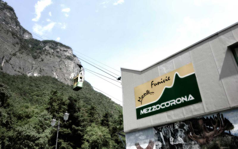
Timetable tram to Monte www.funiviamezzocorona.it
Possible rest stops along the route
Alp Malga Bodrina
Accommodations for overnight stay
Hotels in the hamlet of Monte
Tourist association
Maps
4Land – Sheet 155 – 1:25.000 / Val di Non
 GPX – Track download (78 KB)
 KML – Track download (9 KB)
 PDF – Route description and map download (4.1 MB)